Contact Us

A Multi-Scale ARR and REDD Sustainability Screening Tool

This tool uses data analytics and strategic insights to help create sustainable projects that generate high-integrity carbon credits. This is how our team handled the tech part of the project
  • Portugal

    Country

  • 1 year

    Collaboration duration

  • 5 specialists

    Team

Visit website

About Project: Features & Mission

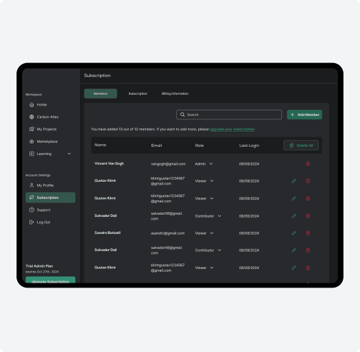
The client is a cloud-based platform that is designed to support Nature-Based Solutions (NbS). The tool helps people plan and run environmental projects, like restoring land, protecting nature, or managing natural resources. It’s built so organizations, local communities, and experts can work together in one place.

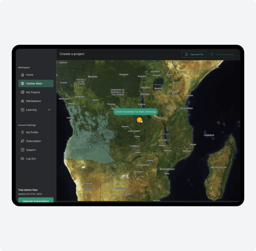
The platform uses map data to show what’s happening in a specific area of land. It collects information about things like land use, soil, water, and other environmental factors and turns that data into clear insights.

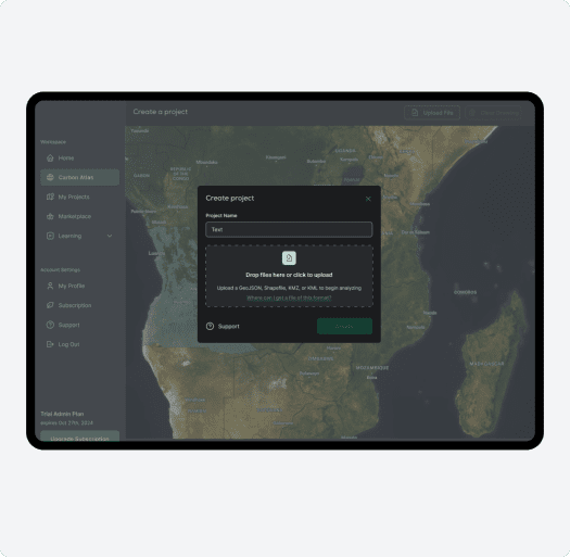
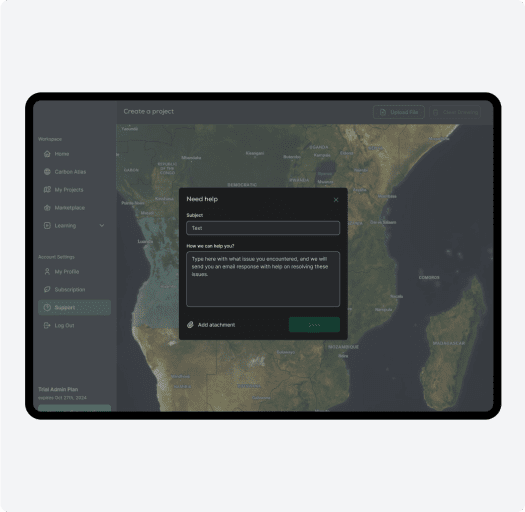
Users can create projects by drawing areas of interest on a 3D globe map or uploading coordinate files. The system automatically checks for available analytical layers at those coordinates and generates a project with detailed analytics capabilities.

About Project: Features & Mission

Key Aspects that Set The Project Apart

  • Multi-Scale Suitability Screening Tool

    This tool uses high-resolution datasets, remote sensing, and machine learning to assess carbon credit project opportunities at varying scales — from country-level overviews to detailed hectare-by-hectare analyses. This helps better identify optimal sites for carbon sequestration projects while aligning with Verra methodologies (VM00047 for ARR and VM00048 for REDD).

  • Dynamic Baselining and Monitoring

    The system incorporates dynamic baselining and continuous monitoring into its project lifecycle. They leverage geospatial intelligence and machine learning to provide real-time validation of carbon sequestration scenarios.

  • Stakeholder Collaboration

    The platform collaborates with local communities, Indigenous groups, and experienced partners to make sure projects are done responsibly and benefit everyone involved. These projects don’t just focus on capturing carbon. They also help protect wildlife, restore nature, and support local communities at the same time. For smaller projects, the system can also use decentralized systems like the Open Forest Protocol. This means project data can be verified in a more open and transparent way, without relying on a single central authority, making it easier for smaller teams to take part and be trusted.

  • High-Integrity Carbon Credits

    Through advanced modeling, rigorous science, and community input, RAMO provides the generation of high-integrity carbon credits that are verifiable, credible, and aligned with global climate goals.

Key Aspects that Set The Project Apart

Challenges of Development

Challenges of Development
  • Processing Massive Geospatial Datasets

    Handling large vector and raster files containing dense environmental data (like forest density and soil composition) required custom optimization techniques to deliver efficient processing and visualization.

  • Providing Scalable Data Visualization

    Displaying complex, layered geospatial data across global maps — while keeping performance smooth — was technically demanding, especially when switching between country-level and local territory views.

  • Implementing Strict Data Access Control

    The client needed a robust multi-tenant system where each company could only access specific datasets and maps. Ensuring tight admin-level control over who sees what added architectural complexity.

  • Integrating Diverse Technologies Seamlessly

    Combining Azure cloud infrastructure, geospatial mapping via Felt, and AI-driven analytics into a single, user-friendly platform required careful coordination across backend and frontend systems.

Our Contribution

  • Cloud-Based Solutions

    Scalable, secure infrastructure designed for handling large-scale geospatial and ecological datasets. We used Azure cloud services to manage and scale backend processing.

  • Geospatial Mapping & GIS Systems

    Our team built a comprehensive system to process vector and raster geodata, preparing them for visualization on a global map. This data includes high-resolution layers with critical environmental indicators such as forest density, soil composition, and other geospatial insights.

  • Processing Vector and Raster Data

    Our team built a system to process vector and raster geodata to prepare them for visualization on a global map. This data includes high-resolution layers with critical environmental indicators.

  • Frontend Integration with Felt API

    Felt was integrated as the primary visualization tool for displaying geospatial data on the frontend. The system creates separate projects for each region or country, enabling stakeholders to explore data territory by territory through an intuitive 3D globe interface.

  • Strict Data Access Control

    The system is designed as a multi-tenant platform, where each company or organization (tenant) only gets access to a limited set of maps and datasets, depending on permissions. The administrator has full control over data sharing and availability, which helps maintain data privacy and integrity.

  • Custom Atlas with Mapbox

    We created a fully customized map interface using Mapbox, complete with a tailored design and a flexible control panel. This setup allows users to overlay Felt projects on top of custom layers, interact with GEO JSON files, draw directly on the map, and even handle massive uploads — including files over 1GB.

  • Stripe Subscription Setup

    Our team integrated Stripe to manage subscription plans, giving the client full flexibility to offer tiered access while keeping billing simple and secure.

Our Contribution
How the Platform Works

How the Platform Works

The platform is built around workspaces (representing companies) where multiple users can collaborate on shared projects. There are three subscription tiers — free, pro, and enterprise (monthly and annual) — to accommodate different organizational needs.

Users can create projects by:

  1. Drawing areas of interest on the 3D globe map

  2. Uploading coordinate files

  3. Reviewing automatically detected analytical layers

  4. Accessing comprehensive analytics for their selected regions


The platform equips these companies with data on forest density, soil composition, and other environmental indicators necessary for carbon credit project development. Plus, an integrated chatbot allows users to ask questions about specific projects or leverage company-uploaded information for contextual insights.
 

Wireframes

These are the wireframes we’ve designed for the project:

Wireframes image 2
From Data to Impact

From Data to Impact

SpdLoad CEO Maksym Babych recently joined the team as COO. With over 12 years of experience in software development and a strong focus on AI-driven solutions, Maksym brings both technical expertise and a deep commitment to creating positive change. While this is a part-time role, he sees the initiative as a powerful way to help companies reach net zero faster and with less friction. As he puts it:
“This project is built to solve a very real challenge: how to scale nature-based solutions without losing scientific integrity or local relevance. In the end, hitting net-zero targets means nothing if the data behind the projects isn’t accurate or transparent.  That’s where GIS, AI, and remote sensing come in — they help us map land use, predict outcomes, and verify carbon impact with confidence. But what makes it different is how we bring all of that together in one platform that’s actually usable by the people doing the work — on the ground, in the field, and in the boardroom.”

Key Features of The System

Key Features of The System
  • End-to-End Project Support

    It provides services such as baseline determination, carbon accounting, monitoring plan development, and ongoing project tracking using satellite imagery and geospatial data.

  • Carbon Credit Development

    The platform specializes in designing projects that generate high-integrity carbon credits while delivering co-benefits for local communities. It ensures compliance with international standards like Verra and CCB.

  • Geospatial Intelligence

    Offers tools for land scanning, risk assessment (e.g., deforestation risks), and suitability analysis for conservation or reforestation projects.

  • Stakeholder Collaboration

    It engages with Indigenous and Local Community Partners (ILCPs) and rural communities to co-develop NbS projects that align with local needs and global sustainability goals.

  • Educational Resources

    Provides professional development programs such as boot camps on AI in nature-based solutions.

Key Features of The System

Technologies We Used In the Development

  • Azure

  • Felt

  • MapBox

  • Nest.js

  • React.js

  • Stripe

Related Services

  • Hire AI Developers

    Accelerate AI adoption and enhance productivity with dedicated AI engineers from SpdLoad.

    Learn more
  • SaaS Development

    Become an industry leader with a SaaS solution that is resilient, scalable, and user-friendly.

    Learn more
  • GIS Development Services

    Make faster, data-driven decisions with interactive maps and spatial analysis.

    Learn more

Summary: Working Towards AI-Driven Sustainability

This project is a great example of how smart tech can help drive real change. Our team focused on building the platform’s technical foundation — from processing massive geospatial datasets to ensuring secure, scalable access for stakeholders.

With that solid foundation in place, the client’s team can focus on what they do best: helping communities and organizations build impactful, transparent carbon credit projects. It’s exciting to know the tools we built will help move important climate work forward. We’re proud to have played a part in something that matters.

Summary: Working Towards AI-Driven Sustainability image 2
Contact Us
Taxi App Redesign: New Features & Better UX
Privacy Overview

This website uses cookies so that we can provide you with the best user experience possible. Cookie information is stored in your browser and performs functions such as recognising you when you return to our website and helping our team to understand which sections of the website you find most interesting and useful.

Necessary

Strictly Necessary Cookie should be enabled at all times so that we can save your preferences for cookie settings.

Analytics

This website uses Google Analytics to collect anonymous information such as the number of visitors to the site, and the most popular pages.

Keeping this cookie enabled helps us to improve our website.

Marketing

This website uses the following additional cookies:

  • Google Ads
  • Microsoft Clarity
  • LinkedIn Insight Tag
  • Twitter/X Pixel