
Talk to Our GIS Experts
Book a call to discuss your project idea with our GIS development specialist.
We deliver full-cycle support from initial concept through ongoing maintenance. Make faster, data-driven decisions with interactive maps and spatial analysis
Get a Quote
We focus on what you're trying to achieve, not just delivering software with features. Each tool we build helps you reach specific goals like cutting costs, serving customers faster, or managing resources better.

Better route planning means less fuel and time spent driving. Improved asset tracking means fewer lost items and faster maintenance. Coordinated field teams complete more work in less time, all of which reduces your operating costs.

Instead of digging through rows of data, you'll see everything on a map that makes sense instantly. When you can spot problems and opportunities at a glance, you can respond faster and with more confidence.

We automate repetitive tasks like updating spreadsheets or checking geographical data accuracy. Your team spends the saved time on important decisions and customer service instead of administrative busywork.

When you add more users, collect more data, or expand to new locations, the system keeps running smoothly. We build foundations that handle growth without requiring expensive rebuilds or slowdowns.

Sensitive location information about customers, assets, or operations gets proper protection from the start. We follow industry regulations and security best practices so you can trust your data is secure.


Book a call to discuss your project idea with our GIS development specialist.
 Discovery & Requirements
  UI/UX Design
  Architecture & Development
  Testing & QA
  Deployment & Integration
  Support & Maintenance
 During discovery, we meet with your team to identify the problems you're solving and the decisions you need to make. We examine your existing data sources, review current workflows, and discuss who will use the system and how. By the end, you'll have a detailed project roadmap with clear milestones, realistic timelines, and transparent cost estimates.
We design map interfaces, data visualization dashboards, and interaction patterns that feel natural to your users. This includes choosing the right map styles, designing filters and search tools, and creating workflows that match how your team actually works. We build interactive prototypes so you can test the experience before development begins, gathering feedback and refining the design until it feels right.
Our developers construct the foundation of your GIS solution, setting up databases for spatial data, building APIs for system communication, and creating the mapping engine that powers your visualizations. Throughout development, we implement features in phases, showing you working software regularly so you can provide feedback and see progress.
To verify that maps render correctly and calculations match expected outcomes, our QA team tests the system with real-world data volumes. We check functionality across different browsers, screen sizes, and mobile devices. Edge cases get special attention: what happens when data is missing, when users enter unexpected values, or when network connections drop. The identified issues are then resolved.
We coordinate the launch to minimize impact on your daily work. This includes transferring your spatial data into the new system, connecting to your existing software platforms, and configuring user permissions and access controls. We provide training sessions for your team, create documentation and user guides, and stay available during the initial rollout to address questions immediately.
After launch, we monitor system performance, track usage patterns, and address any issues that emerge. Regular updates keep your software secure and compatible with evolving technologies. As your business needs change, we add new features, optimize existing functionality, and adjust the system to accommodate new data sources or user requirements.


Route optimization, delivery tracking, and territory management that reduce fuel costs and improve service times.

Precision farming, crop health analysis, and resource management that increase yields while reducing environmental impact.

Infrastructure planning, zoning analysis, and public service optimization that improve quality of life for residents.

Site selection, market analysis, and customer proximity mapping that inform strategic expansion and investment decisions.

Asset tracking, network maintenance, and outage management that improve service reliability and reduce operational costs.
Emergency response planning, constituent services, and public asset management that improve efficiency and citizen satisfaction.

Find out how the cutting-edge innovation in gift-giving that utilizes complex, architect-level solutions works behind the scenes.

Learn more about how the eLearning app implemented an innovative business model for an old problem.

Discover how a startup in HR shapes employee management in enterprise-level companies using complex tech solutions.


Learn how we developed a platform that offers straightforward payroll software.

Find out how we created Paystubs, an online platform designed to enhance the convenience and organization of payrolls.

“Early-launched LegalTech platform acquiring first clients in 3 months”

“A cross-platform design tool for SharePoint, Microsoft Teams, and SAP”

“After launching, the client raised funding with the support of H&S Investments”

“A user-friendly home warranty software focused on transparency and customer choice”
“From manual consulting workflows to a scalable, automated marketplace”

“Scalable MVP that helped founders raise Series A funding”

“Scheduling-first pet care marketplace with real-time tracking and chat”

“Our efficient project management delivered a 20% faster turnaround”

“Unified web and mobile system for therapist workflows and patient data”
Let's discuss how custom spatial intelligence can solve your business challenges.
GIS software development services include creating tailored geographic information system applications that help businesses capture, analyze, visualize, and manage spatial data efficiently. These solutions analyze geospatial data and turn location information into strategic insights.
The main reason is that a specialized GIS software development company, like SpdLoad, brings domain expertise and optimized solutions that reduce time-to-value and project risk. You basically benefit from experience solving spatial challenges across multiple industries and use cases.
The short answer: Any organization dealing with location-based decisions can benefit from a custom GIS application.
The duration of GIS development services depends on project requirements, complexity, and the integrations you need. Simple applications or MVPs typically take up to three months, while comprehensive enterprise solutions may require several months.
The foundation of most GIS solutions is a spatial database, typically PostgreSQL with the PostGIS extension, which stores geographic data and performs spatial queries like “find all points within this area” or “calculate the distance between these locations.” These databases handle millions of geographic features efficiently.
GIS services transform complex spatial data into visual insights that humans process quickly and intuitively. This is especially important when we remember that humans are naturally visual thinkers. We can spot patterns on a map in seconds that would take hours to identify in spreadsheets. When you see all your customer locations colored by revenue or service requests shown as a heat map, trends become obvious. You might immediately notice that high-value customers cluster in specific neighborhoods or that service requests spike in certain areas.
If you’re a non-technical founder, you’ve probably been here before. You have the idea,...
read more
A few things happen when you launch your MVP. Some founders get a flood of signups and realize...
read more
The global IT outsourcing market is on track to surpass $400 billion by 2027. Yet the majority of...
read more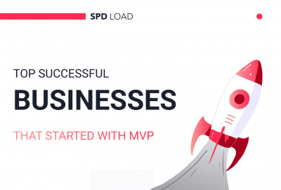
There’s a version of the MVP story that gets told a lot in startup circles. It usually sounds...
read more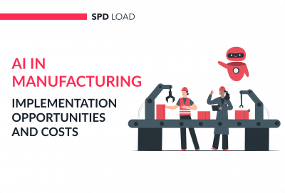
In the manufacturing industry, AI mostly means three things: Analyzing equipment data to catch...
read more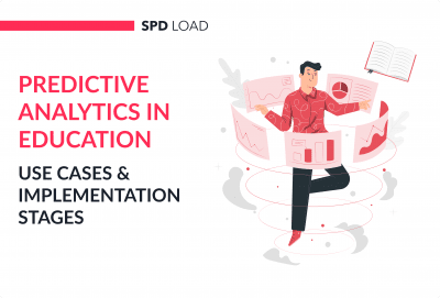
A learner signs up for your course. They complete the first two modules, maybe even leave a comment...
read more


